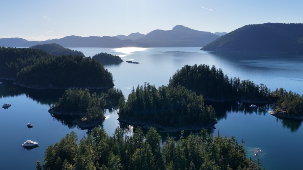
After leaving Refuge Cove, we continued deeper into Desolation Sound and headed for Laura Cove, tucked into the beautiful Prideaux Haven area.
Prideaux Haven is one of the best-known and most popular anchoring areas in Desolation Sound Marine Provincial Park. BC Parks describes it as a very popular anchorage and a strategic base for exploring the Sound, with islands, small coves and protected waterways everywhere you look.
We planned to settle into Laura Cove for a few nights, slow things down and wait for some friends who were joining us for the next part of the adventure.
Our Friends Are Coming to Find Us
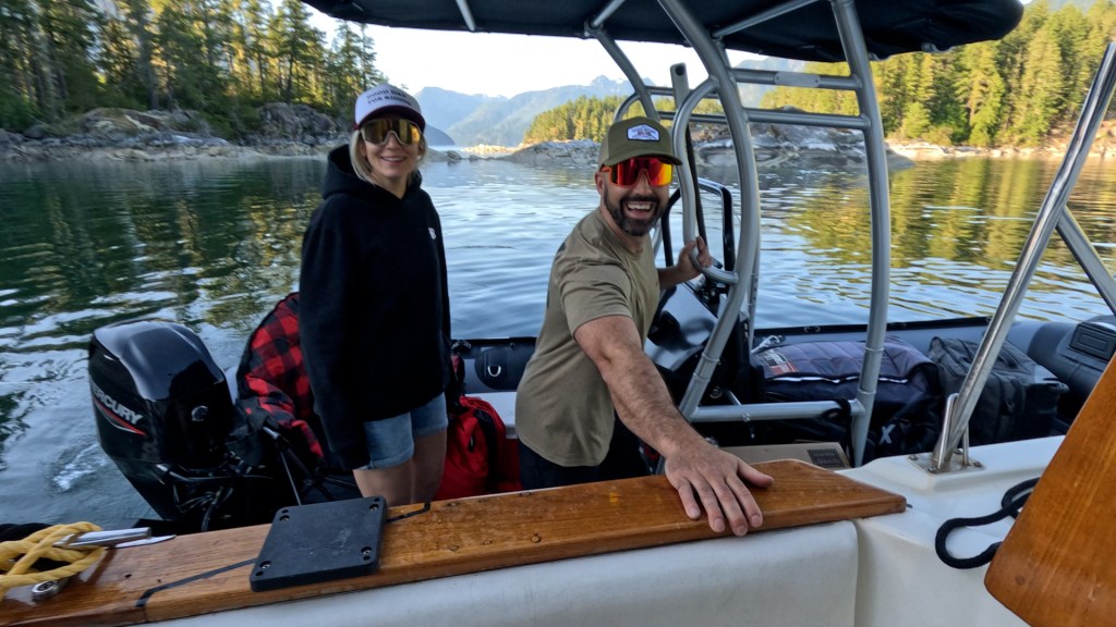
Our friends — and newest Stryker Boats ambassadors — Cody and Claire — were making their way from the Lower Mainland to meet us.
They loaded their gear and their Stryker RIB 470 with a Mercury 60 HP and T-top, drove to Lund, launched the boat, left the vehicle behind and headed up the coast toward Laura Cove.
Not a bad way to arrive for a few days in Desolation Sound.
They weren’t due until later in the afternoon, so we had plenty of time to get ourselves settled and start exploring.
Finding Our Spot in Laura Cove
Laura Cove is noticeably narrower than the main Prideaux Haven anchorage, and it isn’t really a place where you want a larger boat freely swinging around on the hook.
Cruising guidance specifically recommends anchoring with a stern line because the cove is too narrow for many boats to swing comfortably.
Fortunately, Laura Cove has eight dedicated stern-tie points installed along the shoreline. They increase the number of boats that can safely use the anchorage while reducing the damage that used to occur when boaters repeatedly tied lines around shoreline trees.
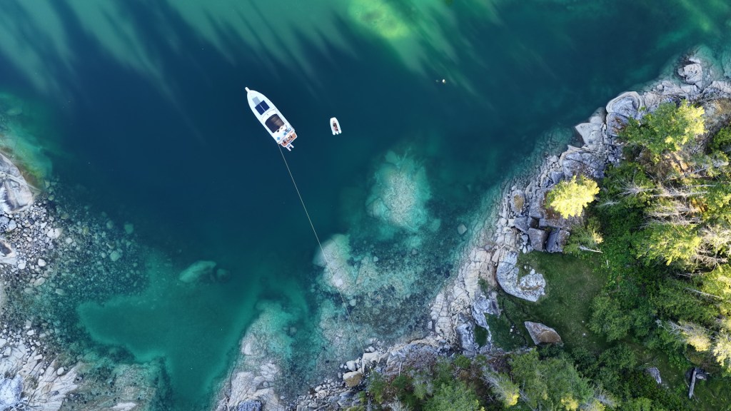
We managed to get what, in our opinion, was probably the best spot in the cove.
We were tucked away, secluded from most of the other boats, with forest surrounding us and a beautiful view out toward the rest of Prideaux Haven.
And being there in June made a huge difference.
Prideaux Haven is famous for getting busy during peak summer. Historical cruising accounts describe Laura and Melanie coves as packed with yachts in July and August, while the high season in general can mean plenty of company throughout the anchorage.
Our June visit felt completely different.
There were other boats around, but it still felt peaceful, quiet and spacious — exactly what we were hoping for.
More Than 150 Years on the Charts
One of the things we love about exploring this part of the BC coast is realizing just how long mariners have been travelling and charting these same waterways.
Many of the familiar names around Prideaux Haven — including Laura Cove, Melanie Cove, Eveleigh Island, Mary Island and William Island — were already appearing on British Admiralty charts in the 1860s.
BC’s Geographical Names Office records Laura and Melanie among the features shown on an 1864 Admiralty chart, while Prideaux Haven itself appeared on British Admiralty Chart 580 by 1865.
So when you’re running a little Stryker through these passages today, you’re travelling through places that have appeared on marine charts for more than 150 years.
Pretty cool.
The Warmest Ocean Water of Our Trip
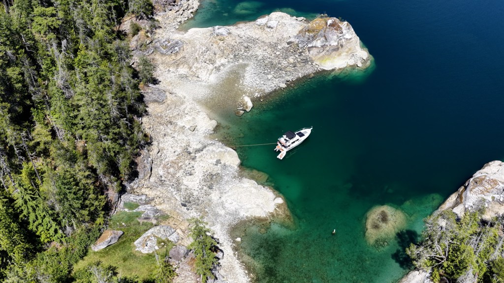
Once the big boat was secured, we launched our Stryker tender and started exploring.
Prideaux Haven is perfect for this.
The area is made up of protected waterways, islands and little passages, with Laura and Melanie coves tucked into the larger anchorage.
And then we discovered something else.
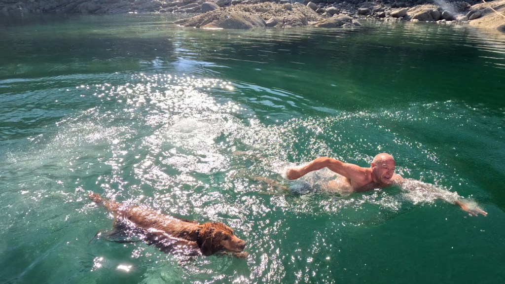
The water was warm.
Really warm.
It was easily the warmest Pacific Ocean water we had experienced anywhere on the trip so far.
Desolation Sound is actually known for unusually warm summer water compared with much of the BC coast, and BC Parks specifically highlights swimming as one of the attractions of the area.
So naturally, we jumped in.
We swam, explored the shoreline in the Stryker and enjoyed our little secluded spot while waiting for Cody and Claire.
A Little Curve of Time History
There’s also a surprising amount of history hiding in the forest around Laura and Melanie coves.
Anyone who has spent much time cruising the BC coast has probably heard of M. Wylie Blanchet’s The Curve of Time, the classic account of her summer voyages with her children along the coast in the 1920s and 1930s. The book was first published in 1961 and has since become a West Coast cruising classic.
Two of the characters Blanchet encountered lived right here.
Mike Shuttler lived in Melanie Cove for decades, while Phil Lavigne — known as “Old Phil the Frenchman” — lived in Laura Cove. Blanchet wrote about both men, and cruising accounts still describe searching for traces of their old cabin sites and terraces around the coves.
Knowing that made our hike between Laura and Melanie feel a little different.
People were exploring these same waters, walking through these same forests and travelling between these little coves long before GPS, Starlink or modern boats existed.
Cody and Claire Arrive
Later that afternoon, we finally spotted another Stryker coming into the cove.
Cody and Claire had made it.
After driving from the Lower Mainland, launching in Lund and running up the coast in their RIB 470, they were officially joining the adventure.
We got them settled in, grabbed some food and decided there was no reason to stay put.
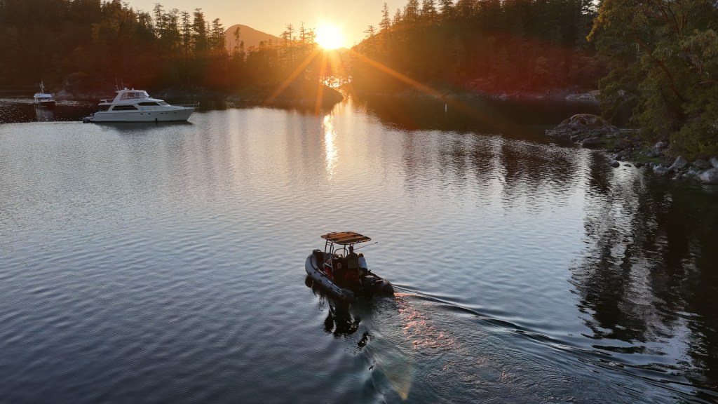
We headed into Melanie Cove and then out toward a small island to watch the sunset.
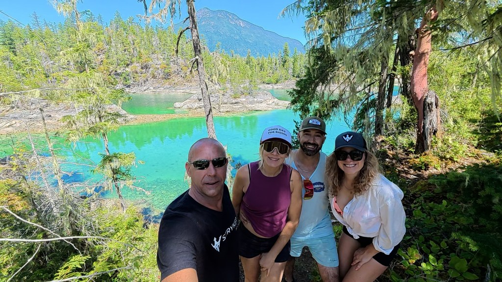
It was one of those evenings that didn’t need much planning.
A couple of boats.
A snack.
Good friends.
And another incredible Desolation Sound sunset.
Hiking From Laura Cove to Melanie Cove
The following morning, we loaded everyone into our Stryker RIB LX 330 and headed to the end of Laura Cove.
From there, we went ashore and started exploring through the forest toward Melanie Cove.
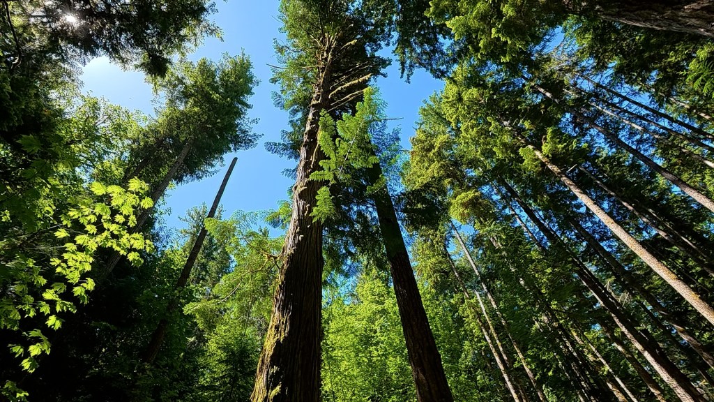
The trees in this area are incredible.
Huge trunks, thick moss and dense coastal forest surround you, and within minutes it feels like you’re nowhere near the ocean at all.
We eventually made our way over toward Melanie Cove, went swimming again and spent far more time exploring than we’d originally planned.
We had left the tender around 11:30 a.m.
By the time we finally started heading back, it was closer to 2:00 p.m.
And apparently we’d been having a little too much fun.
Where’s the Water?
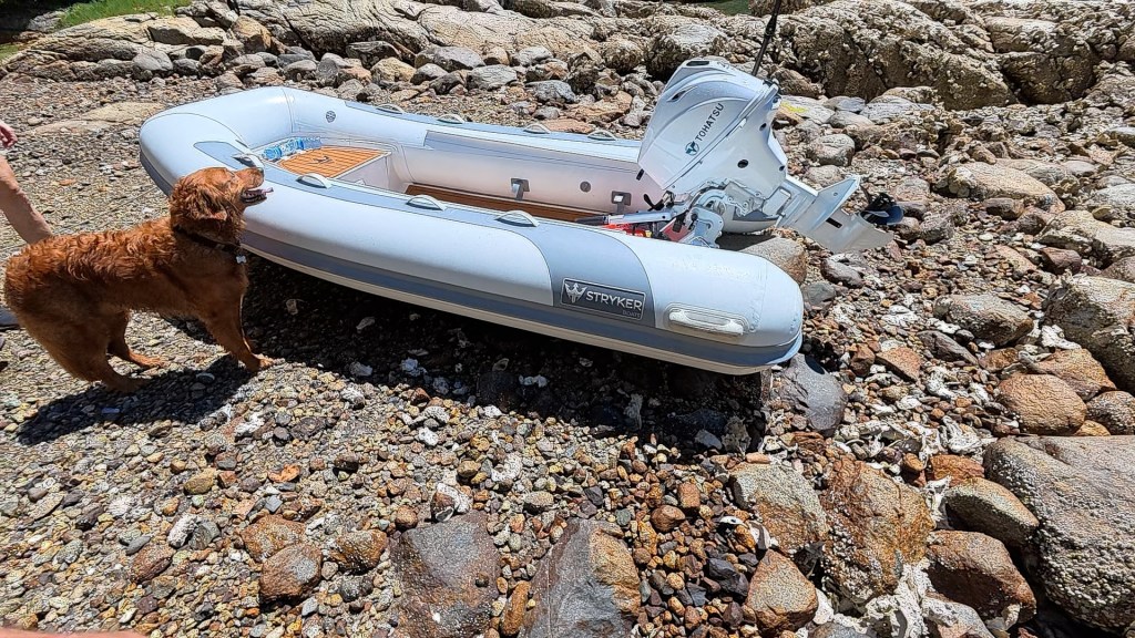
When we came back through the trees toward the beach, the Stryker wasn’t exactly where we’d left it.
Well… technically it was.
The water wasn’t.
The tide had dropped considerably while we were away, leaving our tender sitting high on the beach.
We hadn’t really forgotten about the tide.
We had just completely lost track of time.
Fortunately, there were four of us.
Each person grabbed a handle and we started moving the boat back toward the water.
Good thing inflatable boats have lots of handles.
And good thing there were four of us.
Eventually we got her floating again, climbed aboard and headed back to the big boat.
It was one of those moments that became funny almost immediately.
And honestly, if losing track of time because you’re hiking, swimming and exploring with friends is the biggest problem of the day, you’re probably doing something right.
Deer, Strykers and One More Sunset
Back at the anchorage, everyone jumped in the water again.
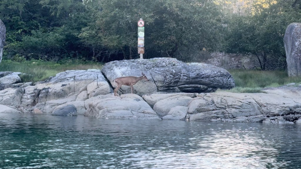
We relaxed, spotted some deer along the shoreline and eventually climbed aboard Cody and Claire’s RIB 470 for another run toward Melanie Cove.
We found a tiny island, shut everything down and watched another incredible sunset.
It had been a full day.
Hiking.
Swimming.
Boating.
Wildlife.
A little unexpected boat carrying.
And a lot of laughs.
And as the sun disappeared behind the mountains, it was hard not to appreciate where we were.
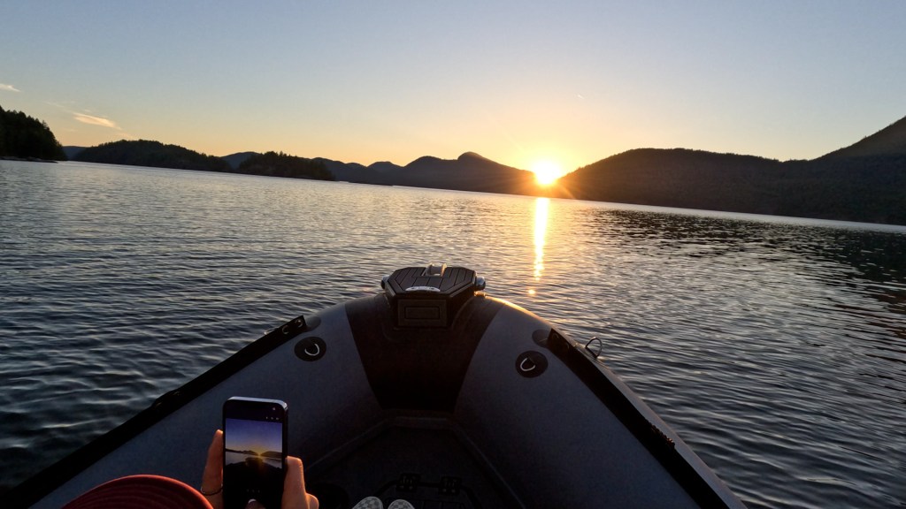
Prideaux Haven may be one of Desolation Sound’s most popular anchorages today, but sitting on a tiny island at sunset with a few friends, it can still feel like you’ve found your own little corner of the coast.
Good friends. Beautiful places. A couple of Strykers. No real plan.
Exactly how we like it.
Visiting Laura Cove & Melanie Cove
Laura Cove and Melanie Cove are within Desolation Sound Marine Provincial Park and the Prideaux Haven anchorage area. Prideaux Haven is one of the park’s major boating destinations and serves as an excellent base for exploring the surrounding Sound.
If you’re planning to hike in the area, check BC Parks’ current advisories before heading out. Portions of established trails around Prideaux Haven, including parts of the Melanie Cove Beach Trail and Viewpoint Trail, are currently closed for ecological restoration, so follow posted signs and closures.
Full video of the Laura Cove adventure coming to the Off Grid Enthusiasts YouTube channel this Thursday — check back soon!


Leave a comment